Large maps of Mexico with cities and roads
We offer you free and good quality world maps, continents and countries. Many geographical maps to download and print for free.


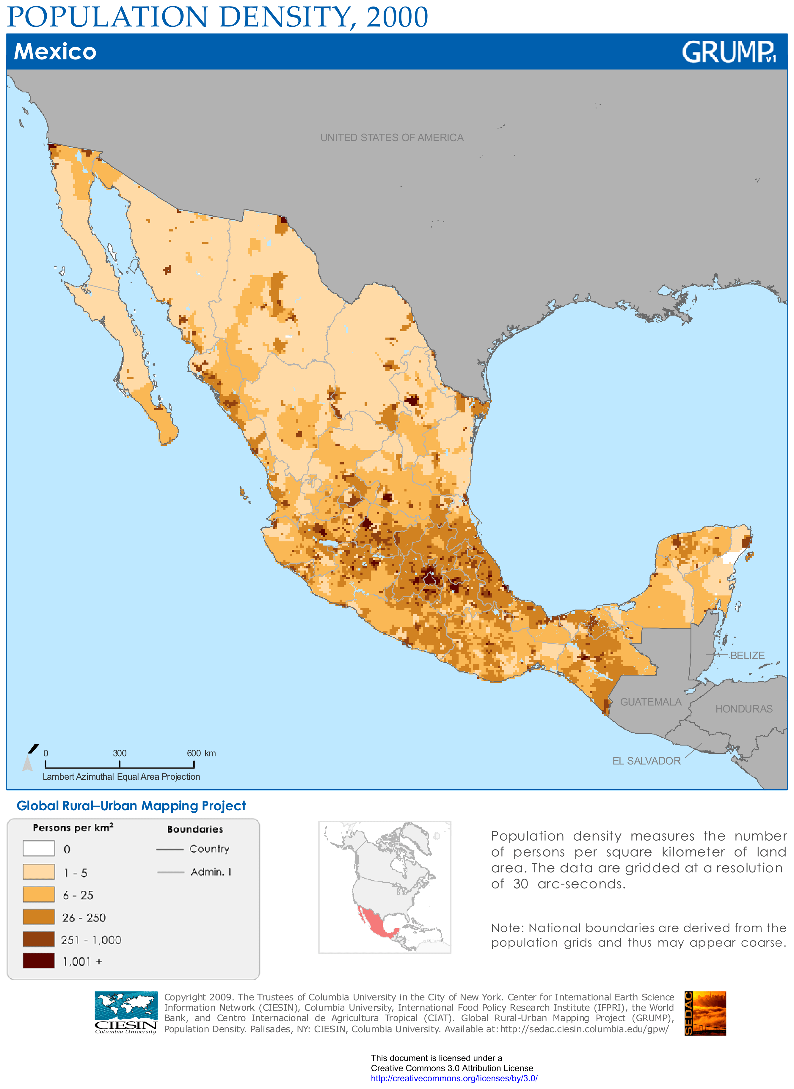
Mexico population density map

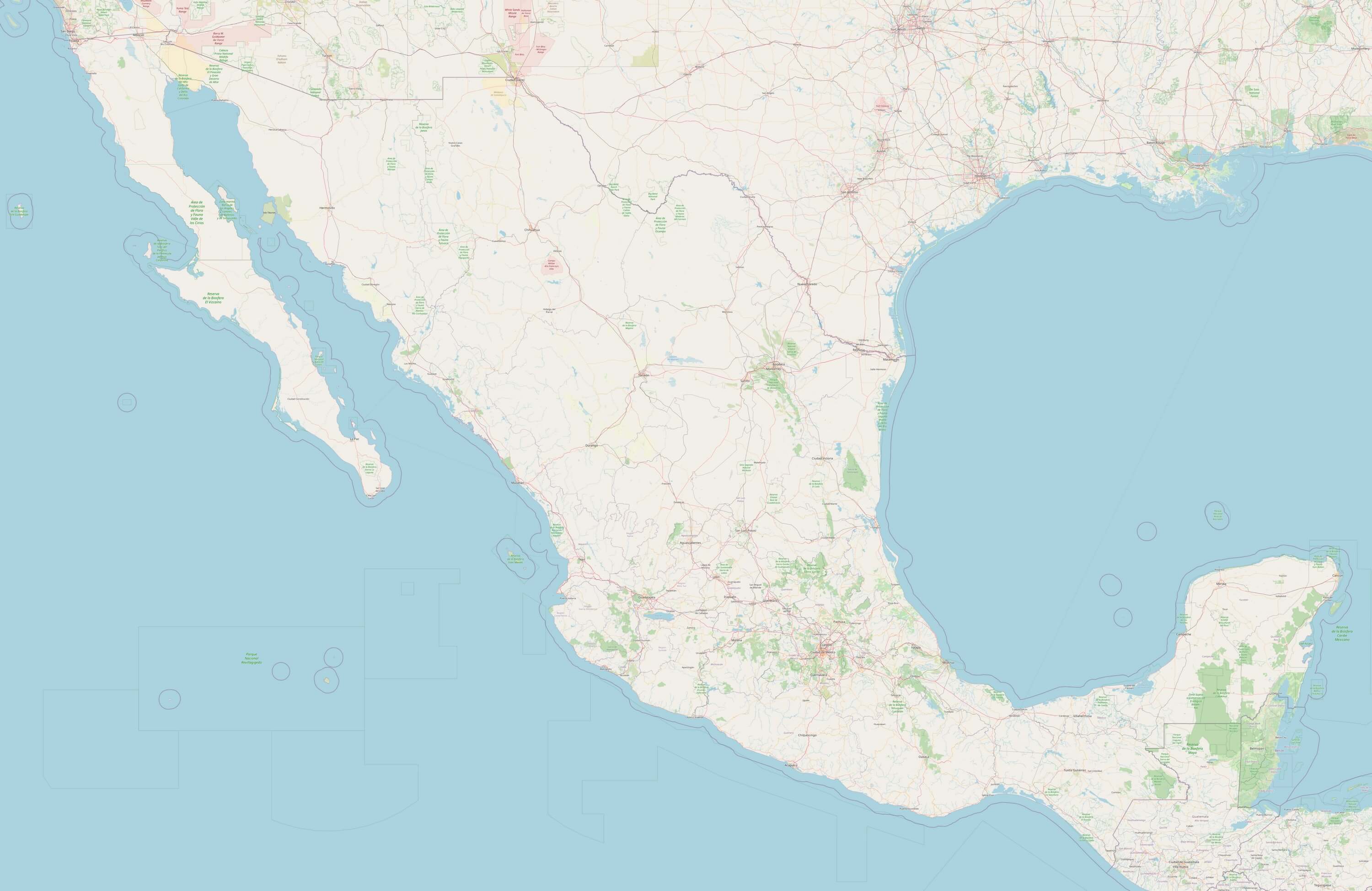
Detailed Mexico map

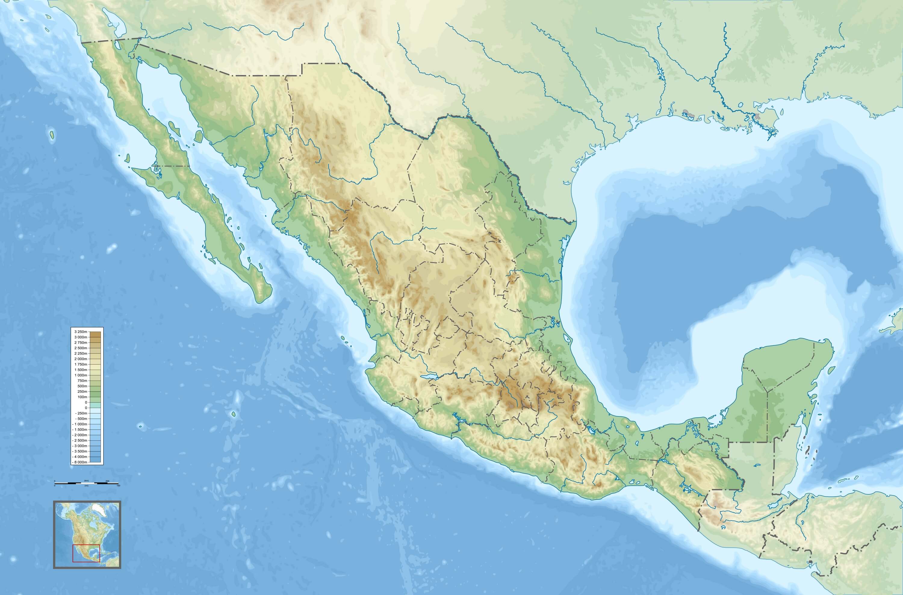
Map of Mexico with relief and altitude

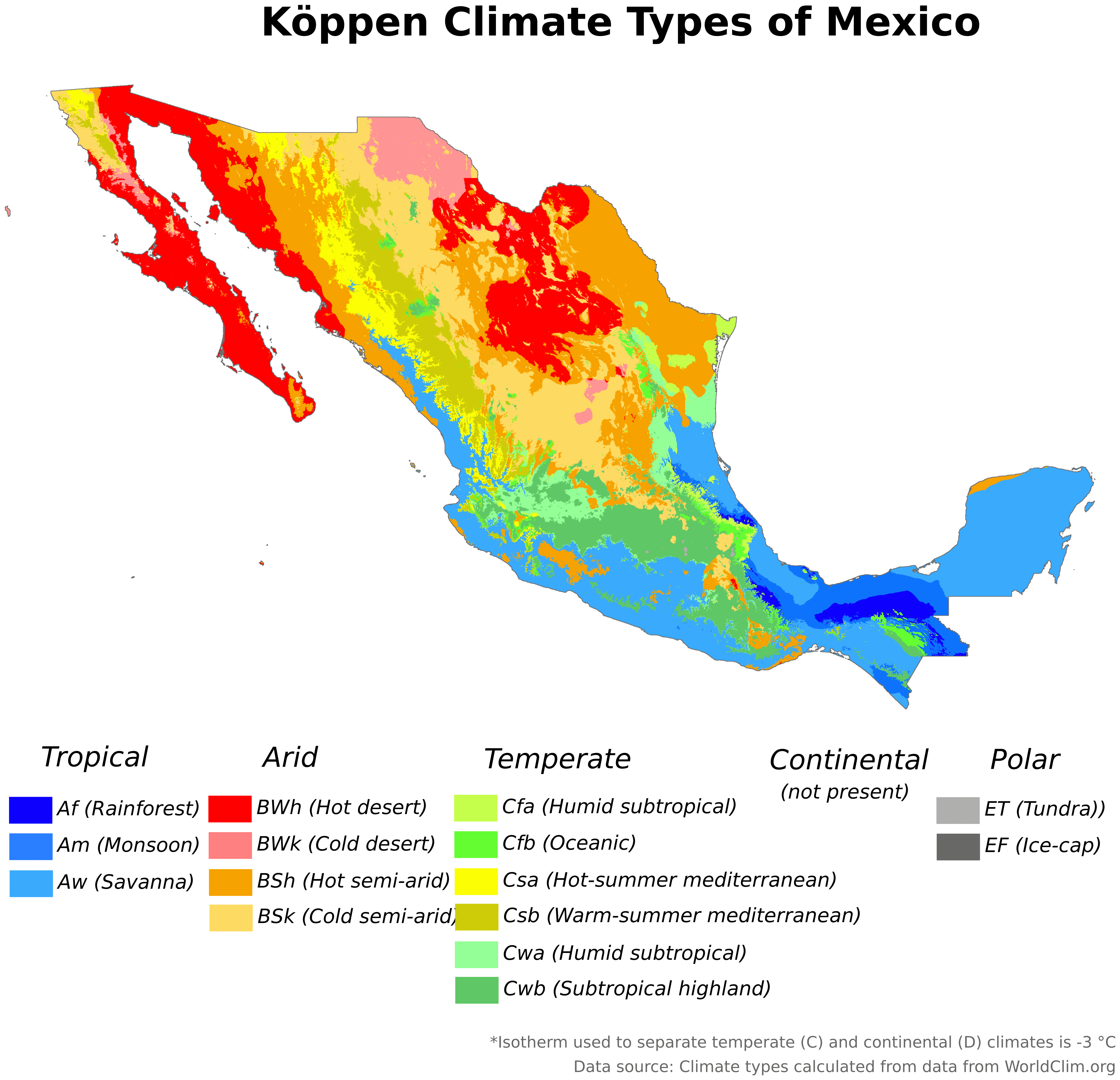
Climate map of Mexico

Download: JPG (1200 x 1158 pixels) | JPG (3000 x 1976 pixels) | JPG (4724 x 4557 pixels) | PNG | PDF | SVG
Description: Mexico climate map with climates in color according to the Köppen classification in 2016, calculated from data from WorldClim.org.
License: CC BY-SA 4.0
Author: Adam Peterson
Source file: Wikimedia Commons (view)
Description: Mexico climate map with climates in color according to the Köppen classification in 2016, calculated from data from WorldClim.org.
License: CC BY-SA 4.0
Author: Adam Peterson
Source file: Wikimedia Commons (view)