Map of countries with capital and cities
We offer you free and good quality world maps, continents and countries. Many geographical maps to download and print for free.


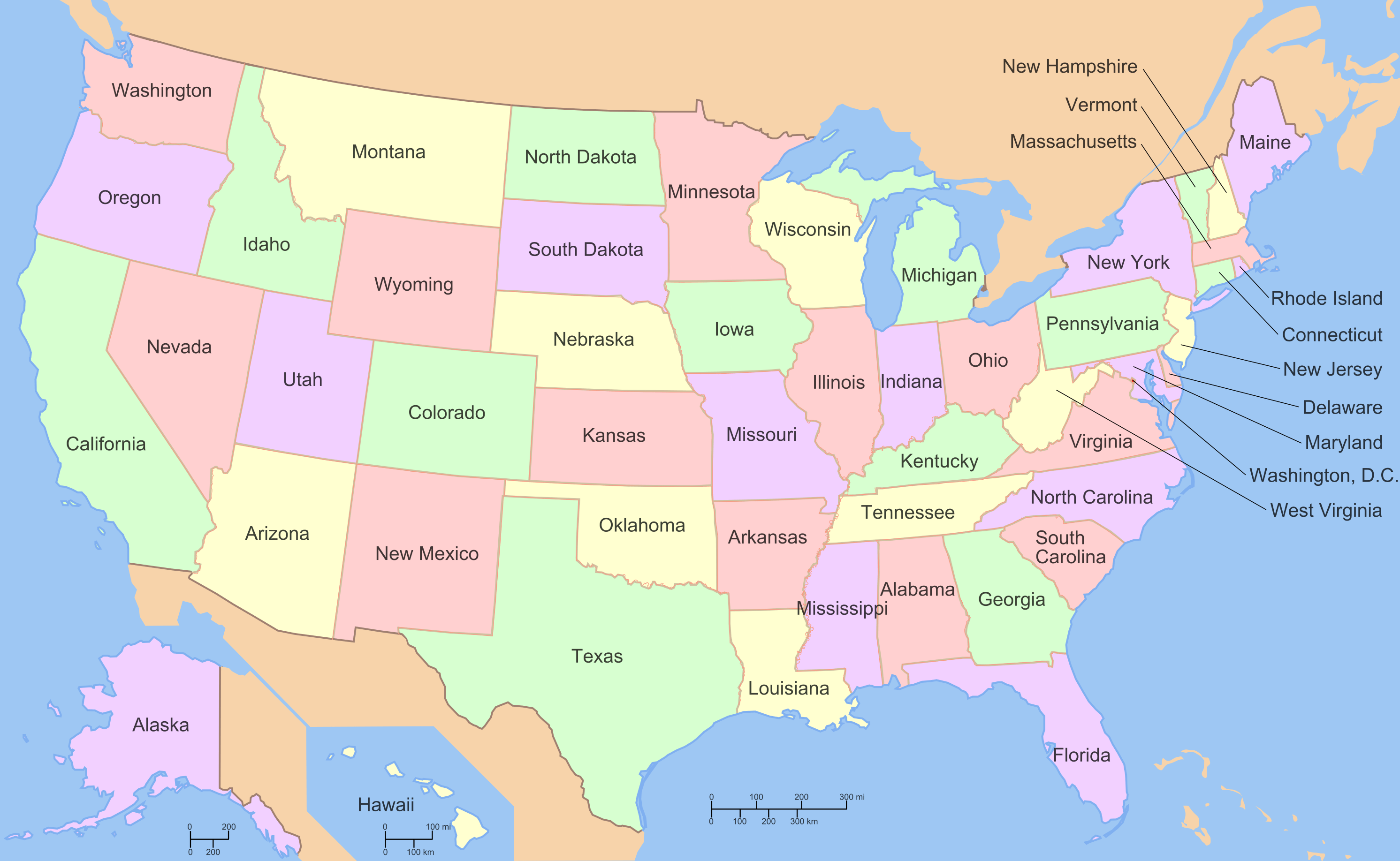
Map of USA with state names

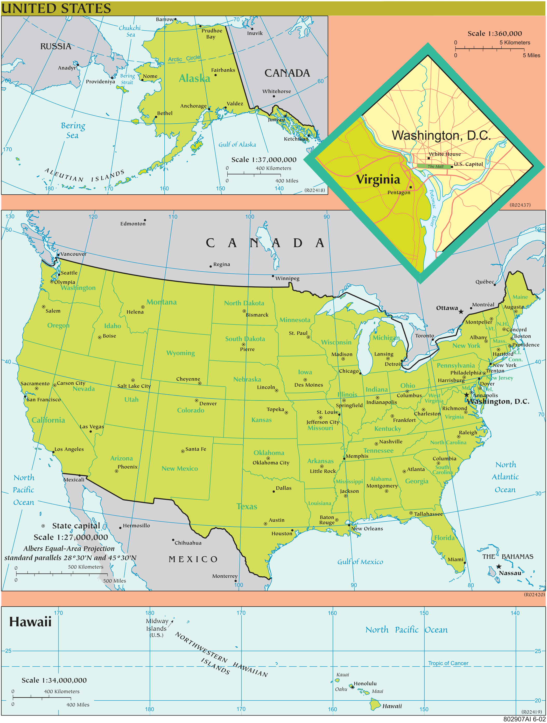
Map of the United States

Download: JPG (908 x 1200 pixels) | JPG (2110 x 2790 pixels) | PNG | PDF
Description: Map of the United States with cities and states, including the state of Hawaii and Alaska.
License: Public domain
Author: US Government, Central Intelligence Agency
Source file: The World Factbook 2020 Central Intelligence Agency.
Description: Map of the United States with cities and states, including the state of Hawaii and Alaska.
License: Public domain
Author: US Government, Central Intelligence Agency
Source file: The World Factbook 2020 Central Intelligence Agency.
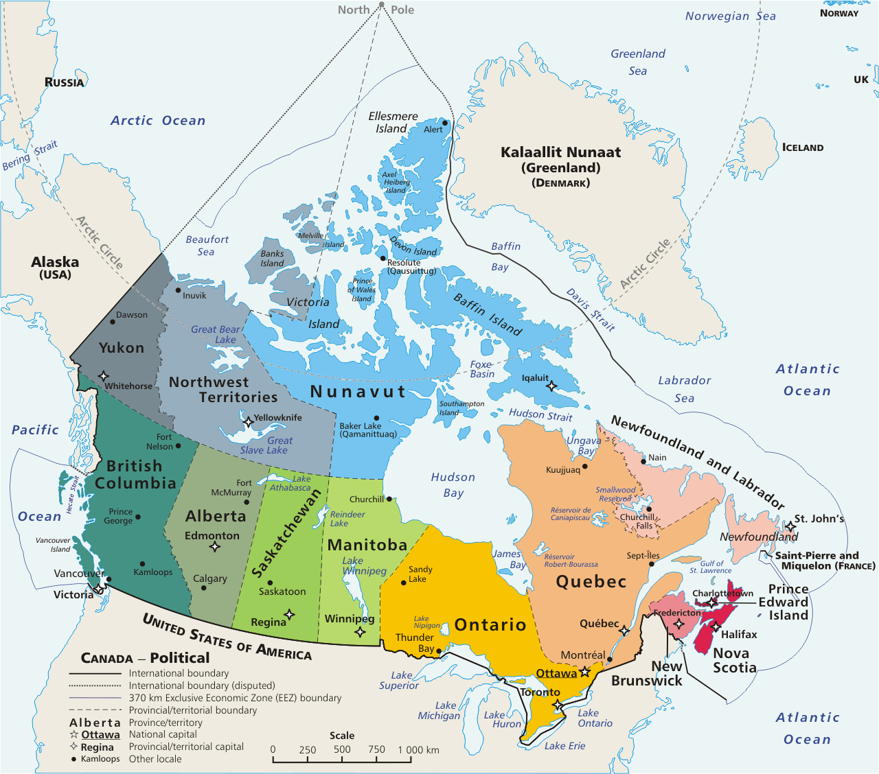
Political map of Canada
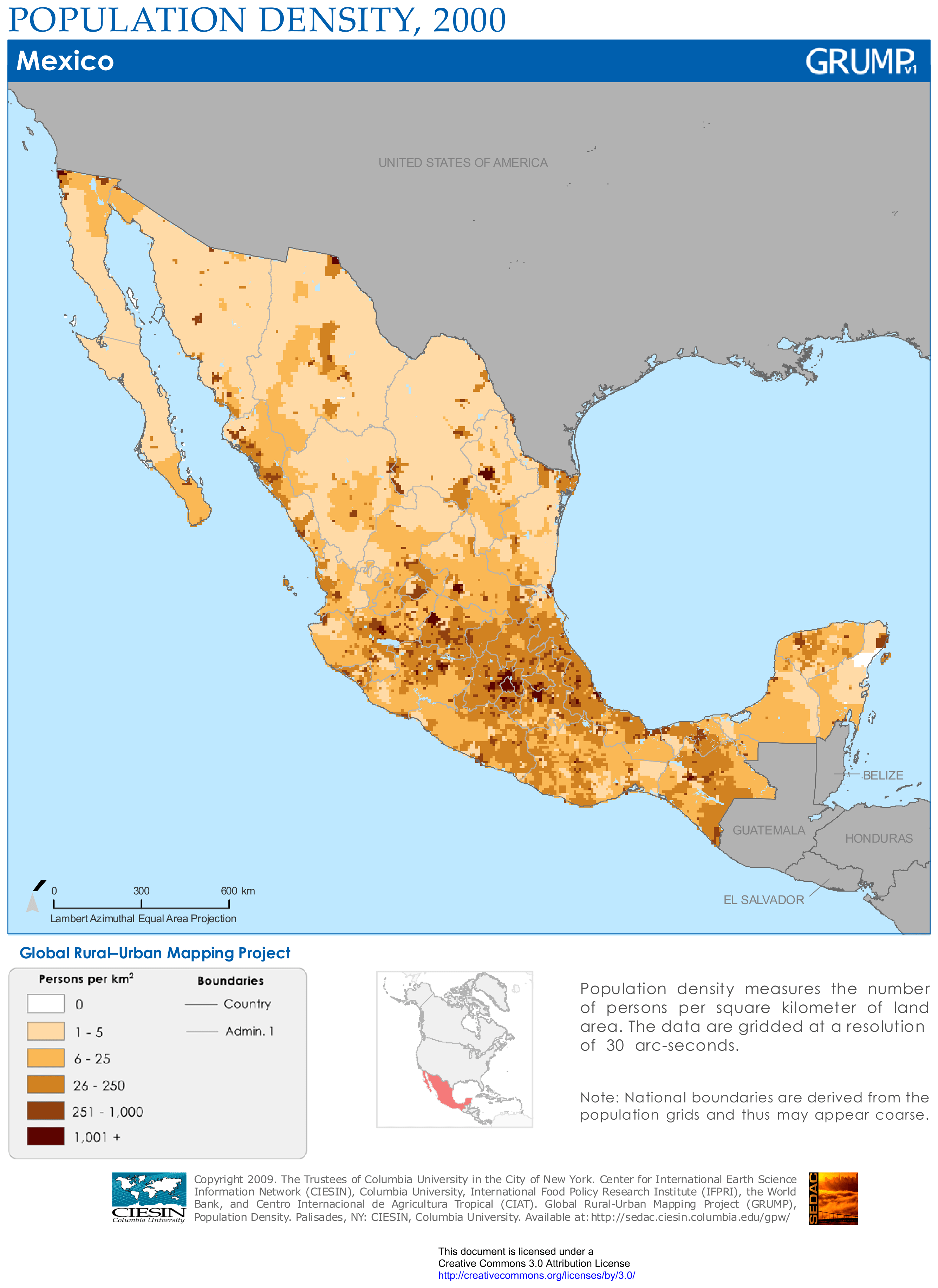
Mexico population density map
