Large maps of Canada with cities
We offer you free and good quality world maps, continents and countries. Many geographical maps to download and print for free.


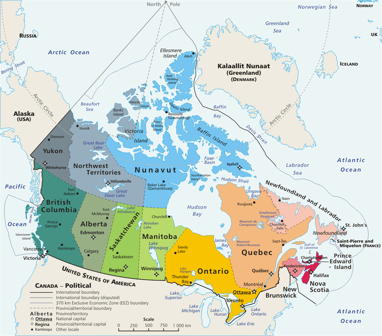
Political map of Canada
Detailed Canada map

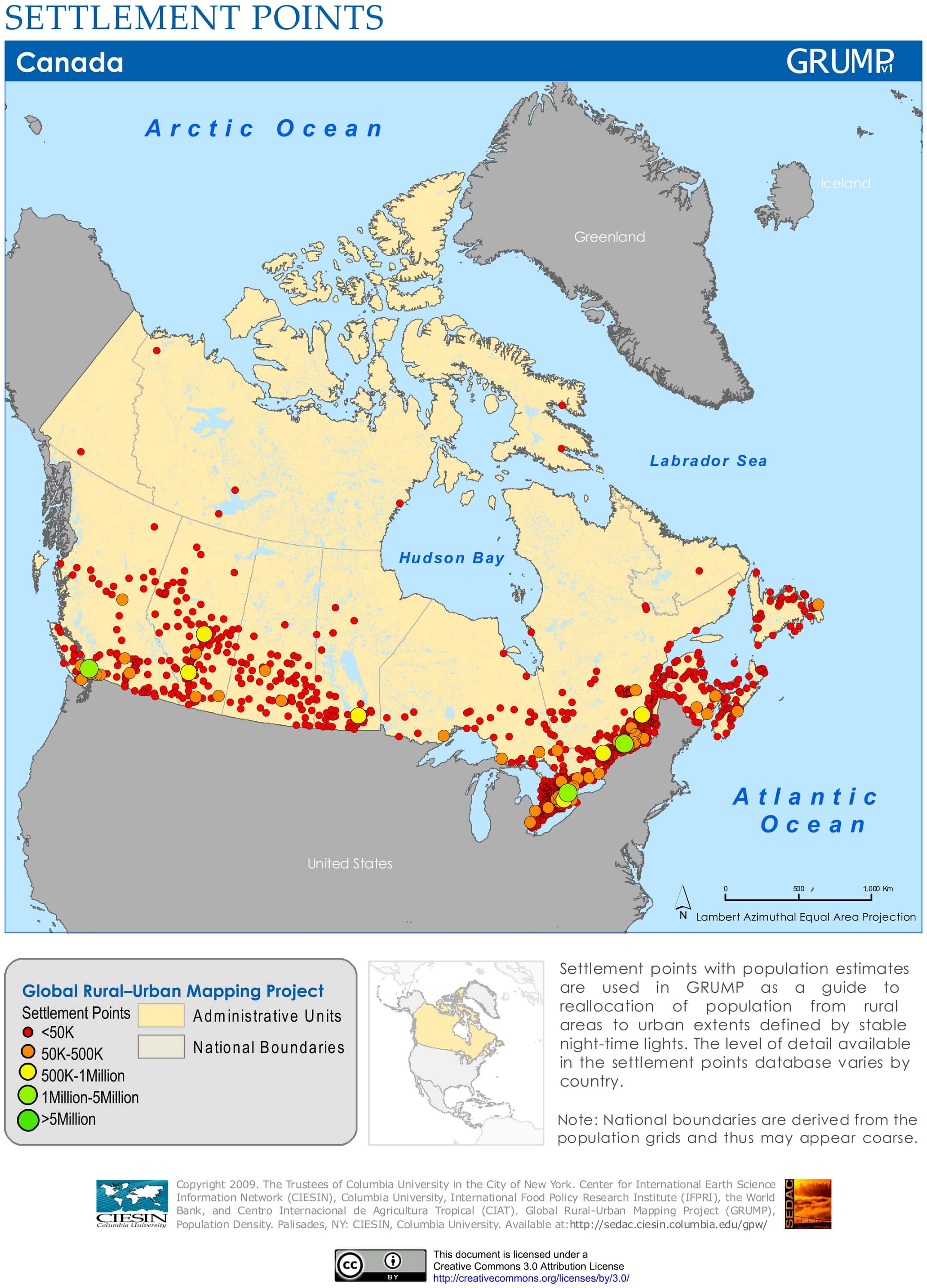
Map of Canada with settlement points

Download: JPG (864 x 1200 pixels) | JPG (2159 x 3000 pixels) | JPG (4544 x 6313 pixels) | PNG | PDF
Description: Map of Canada with population points according to city size and with administrative divisions.
License: CC BY 3.0
Author: Center for International Earth Science Information Network (CIESIN)
Source file: Columbia University of New York (view)
Description: Map of Canada with population points according to city size and with administrative divisions.
License: CC BY 3.0
Author: Center for International Earth Science Information Network (CIESIN)
Source file: Columbia University of New York (view)
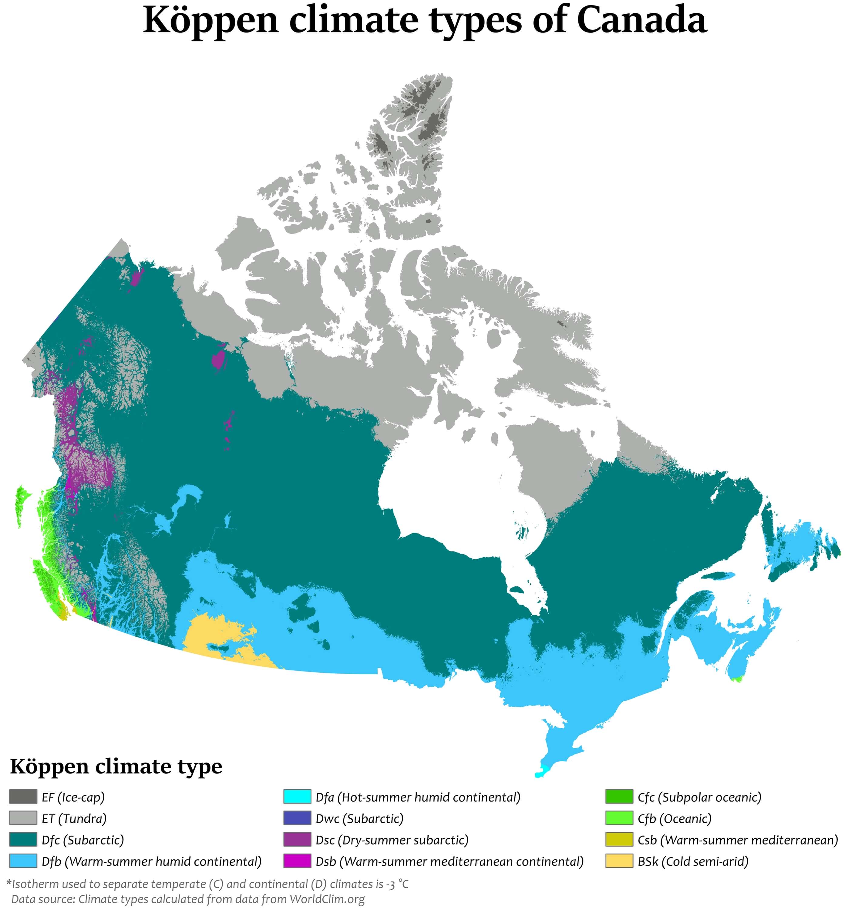
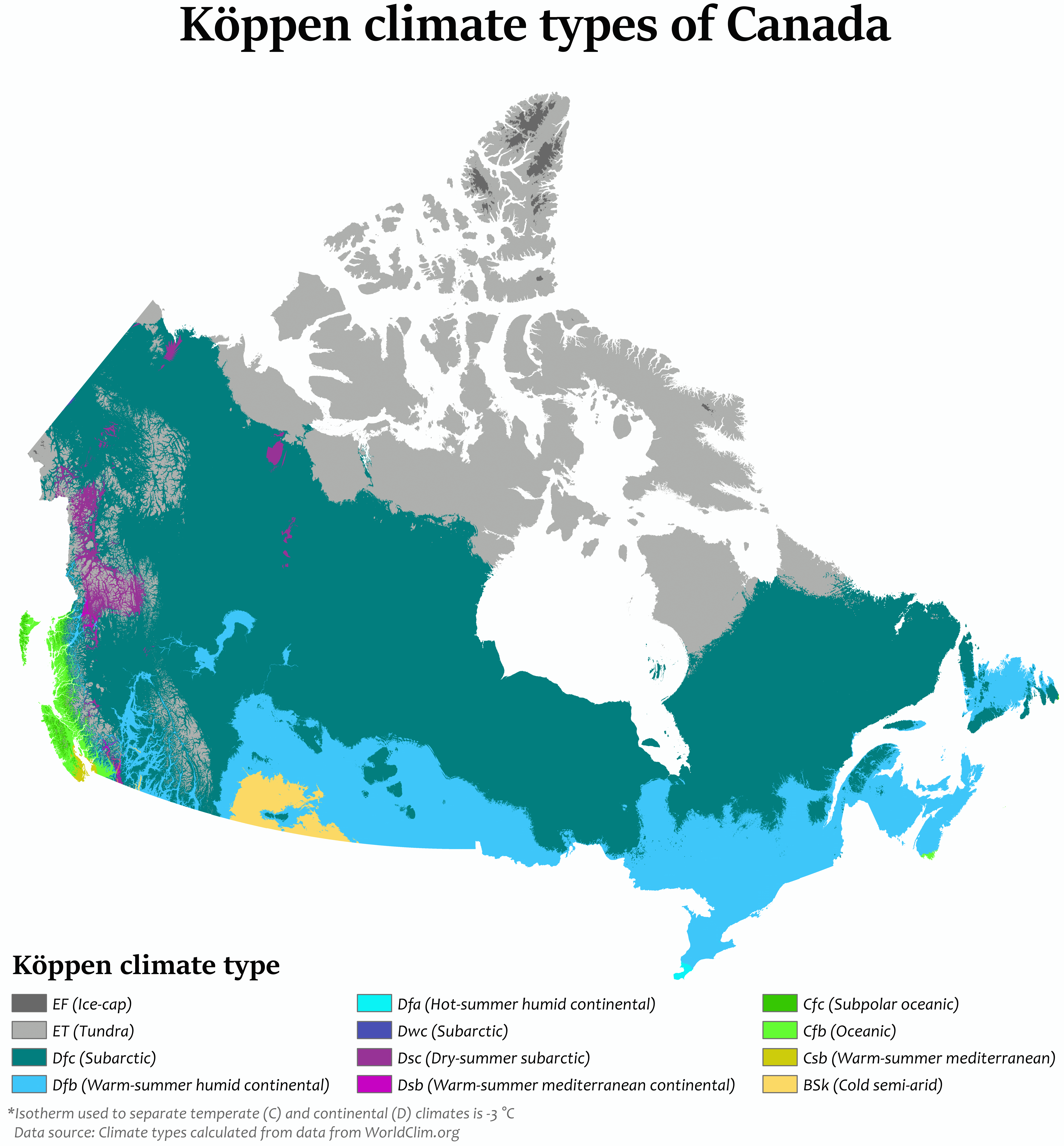
Climate map of Canada
